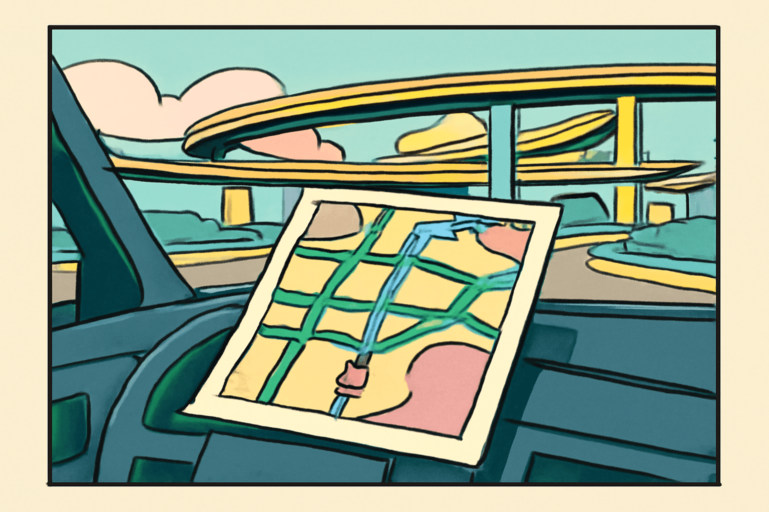
The printer was still going. That was the problem. You'd typed in your aunt's address in Scottsdale, clicked "Get Directions" on MapQuest, and now your HP DeskJet 722C was grinding out page after page like it was printing the Gutenberg Bible. Fourteen steps to get across Phoenix had become four pages of turn-by-turn directions, complete with a map so pixelated it could have been modern art. You were leaving in twenty minutes. The ink was already running low.
This was travel planning in 1998. This was how we got places.
The Printout
MapQuest directions were an act of faith. You printed them, you stapled them, and you handed them to whoever was riding shotgun with the understanding that this stack of warm paper was the only thing standing between your family and being completely, hopelessly lost somewhere outside Barstow.
The directions were precise in a way that felt scientific but was often fictional. "Turn right on CR-14 in 0.3 miles." Great. Wonderful. Except CR-14 didn't have a sign. Or it had a sign, but the sign said "County Road 14" and you spent a critical four seconds wondering if that was the same thing while doing 55 and your mom was screaming "is this it? IS THIS IT?"
MapQuest gave you the confidence of a plan and the fragility of one wrong turn to destroy it completely.
Every trip had a rhythm. Step one through step four were easy - you knew those roads, you'd driven them a hundred times. Steps five through eight were the middle passage, highways mostly, where you could relax. But then came the last page. The final six steps. Unfamiliar territory. Suburban streets that all looked the same. Cul-de-sacs named after trees that didn't grow there. Pinewood Lane. Aspen Court. Birchwood Drive. You were reading the printout with both hands, trying to match the real world to a set of instructions written by an algorithm that had never actually been to this neighborhood.
And if you missed a turn? If you sailed past step eleven and realized it three minutes later?
The printout was useless. Finished. It didn't have a "recalculating" feature. It had nothing for you. You were now off the map, literally, holding four pages of directions that described a route you were no longer on. You might as well have been holding a restaurant menu.
The Co-Pilot
The passenger seat in the 90s was not a place to relax. It was a duty station. If you were riding shotgun, you were the navigator, and the navigator had one job: read the directions aloud at the right time. Not too early, not too late. You were air traffic control for a Ford Taurus.
"Okay, in two miles, you're going to want to get in the left lane."
"Which exit?"
"It says exit 14B."
"14B or 14? Because I see 14."
"It just says 14B. Wait - no. Let me look again."
This was the dialogue of every American road trip. The driver gripping the wheel, the co-pilot squinting at a printout, and the people in the back seat pretending to be asleep so they wouldn't get blamed for anything. There was a specific kind of marital tension that only MapQuest directions could produce. I'm convinced at least a few divorces in this country can be traced back to a missed exit on I-95.
The Glove Compartment
Before MapQuest, there were maps. Actual paper maps. And every car in America had a glove compartment stuffed with them like a file cabinet nobody maintained.
Gas station maps from three states you hadn't visited in years. A AAA map of the Greater Cincinnati area from 1993 with a coffee stain on Hamilton County. A map of Florida that your dad swore was still accurate even though it was printed before they built the new interchange. These maps were folded in ways that defied the laws of physics. You could never refold them the way they came. Never. You'd try, and you'd end up with something that looked like a paper football, and you'd shove it back in the glove compartment on top of the registration and a flashlight with dead batteries.
- Three to seven maps, none folded correctly
- Vehicle registration (expired)
- A flashlight (dead batteries)
- Napkins from Wendy's
- A pen that didn't work
- One cassette tape with no case
- A tire pressure gauge nobody knew how to read
- Owner's manual, untouched
The Thomas Guide was the prestige version. If you lived in LA or any major metro area, you knew the Thomas Guide - that massive spiral-bound book of maps, page after page of gridded streets. You'd look up your destination in the index, find the page and grid coordinate, then flip to it. Page 47, grid D-7. And if your route crossed from one page to another, you were flipping back and forth like a student cramming for finals. The Thomas Guide was the size of a small laptop and weighed about the same. People kept them in their cars like sacred texts. Which, honestly, they were.
Dad Will Figure It Out
There was an unspoken rule in every family I knew: Dad did not ask for directions. This was not negotiable. You could be forty-five minutes late to your cousin's graduation party, circling the same three blocks in an unfamiliar suburb, and Dad was handling it. He had a system. The system was driving in increasingly large rectangles until something looked familiar.
"Jim, just pull into that gas station and ask."
"I know where I am."
He did not know where he was. Nobody in the car believed he knew where he was. But we all understood that pulling into a Texaco and admitting uncertainty to a stranger was, for fathers of that era, a spiritual impossibility. So we drove. We made another rectangle. We passed the same Dairy Queen for the third time. And eventually - through some combination of luck, stubbornness, and what I can only describe as paternal sonar - we got there. Forty minutes late. No one mentioned it.
Asking for directions wasn't just inconvenient. For dads in the 90s, it was an existential crisis.
The AAA TripTik
If you were a AAA family, you had access to the TripTik, and the TripTik was the luxury version of getting somewhere. You'd walk into the AAA office - which always looked like a travel agency from 1987, because it was - and someone behind a desk would make you a custom booklet. Your route, highlighted in yellow marker on a series of narrow strip maps, spiral-bound and ready to go.
The TripTik felt official. It felt like someone with authority had personally approved your vacation. The maps were clean, the route was marked, and there were little symbols showing you where the construction zones were and where you could stop for gas. It was the closest thing the 90s had to turn-by-turn navigation, except it was made of paper and required a human being with a highlighter to produce.
My parents would plan the whole drive to Myrtle Beach around the TripTik. How far to drive each day. Where to stop for the night. Which Holiday Inn had a pool. It was project management for people who didn't know that term yet.
What We Lost
Here's what I think about sometimes. GPS is better. Obviously it's better. I'm not going to pretend that getting lost outside Albuquerque for an hour because your MapQuest printout said "bear right" at a fork that had three options was somehow a richer human experience. It wasn't. It was stressful and bad.
But something happened in that car that doesn't happen anymore. You had to work together. The driver and the co-pilot were a team, and the stakes were real in a small, manageable way. You had to pay attention to the world outside the windshield - read signs, notice landmarks, develop a sense of direction that was yours, not an algorithm's. You built a mental map of places, and that map lived in your body, not your phone.
Now I type an address into my phone and I follow the blue line and I arrive. I don't know how I got there. I couldn't tell you a single road I was on. I didn't need to know. The knowing was outsourced.
I still have a Thomas Guide in my garage somewhere. I haven't opened it in fifteen years. The freeways it shows probably don't match reality anymore. But I keep it anyway, next to a box of dead batteries and a flashlight that works.
Old habits. Old maps. You don't throw them away. You just stop needing them.